| Title Details: | |
|
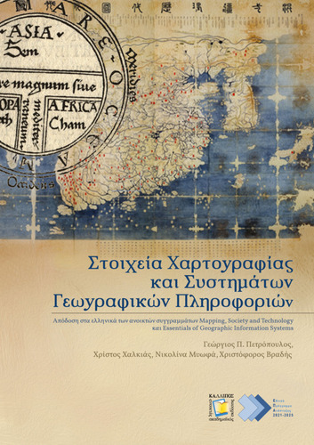
Elements of Cartography and Geographic Information Systems |
|
| Authors: |
Petropoulos, George (Tr.) Chalkias, Christos (Tr.) Myofa, Nikolina (Tr.) Vradis, Christoforos (Tr.) |
| Reviewer: |
Maloutas, Thomas |
| Subject: | NATURAL SCIENCES AND AGRICULTURAL SCIENCES > EARTH SCIENCES > GEOGRAPHY > MATHEMATICAL GEOGRAPHY > CARTOGRAPHY- GEOVISUALIZATION NATURAL SCIENCES AND AGRICULTURAL SCIENCES > EARTH SCIENCES > GEOGRAPHY > MATHEMATICAL GEOGRAPHY > CARTOGRAPHY- GEOVISUALIZATION > THEMATIC CARTOGRAPHY NATURAL SCIENCES AND AGRICULTURAL SCIENCES > EARTH SCIENCES > GEOGRAPHY > GEOGRAPHICAL CARTOGRAPHY NATURAL SCIENCES AND AGRICULTURAL SCIENCES > EARTH SCIENCES > GEOGRAPHY > GEO-INFORMATICS NATURAL SCIENCES AND AGRICULTURAL SCIENCES > EARTH SCIENCES > GEOGRAPHY > GEO-INFORMATICS > GEOGRAPHIC INFORMATION SYSTEMS ENGINEERING AND TECHNOLOGY > TECHNOLOGICAL SCIENCES AND ENGINEERING > RURAL AND SURVEYING ENGINEERING > GEOGRAPHIC INFORMATION SYSTEMS (GIS) ENGINEERING AND TECHNOLOGY > TECHNOLOGICAL SCIENCES AND ENGINEERING > RURAL AND SURVEYING ENGINEERING > CARTOGRAPHY- GEOVISUALIZATION |
| Keywords: |
Cartography
Geographic Information Systems Mental maps Thematic maps Geospatial Data Visualization Map projections Map scale Map symbolization Vector data Raster data Spatial Analysis Lying with maps Volunteered Geographic Information Digital gap |
| Description: | |
| Abstract: |
The book is an introduction to modern Cartography as it can be approached through Geographical Information Systems. Moreover, Cartography is considered to be an integral and interrelated part of GIS. The book is written in a comprehensive manner and is primarily addressed to undergraduate students of the Department of Geography, School of Environment, Geography and Applied Economics of Harokopio University. It is one of the books used in the undergraduate modules "Introduction to Cartography", "Thematic Cartography" and "Geographic Information Systems I". Secondly, it is addressed to anyone who would like to expand their knowledge and skills in Cartography, map composition, and the way in which Geographic Information Systems may be used as a tool in Chartography. This academic book is the outcome of the composition of two different books written in English, which are available under open licenses: Mapping, Society and Technology by Steven Manson (editor) and Essentials of Geographical Information Systems by Jonathan Campbell and Michael Shin. Specific chapters were selected from the above two books and translated into Greek. The book consists of 14 chapters. Apart fromr the examples that focus on the geographical and social particularity of the USA the author team supplementarily added paradigms that have to do with the Greek reality. The main aim of this addition is for the Greek readers to understand in a better way the theoretical context of Cartography through paradigms that are more understandable.
|
| Linguistic Editors: |
Myofa, Nikolina Vradis, Christoforos |
| Technical Editors: |
Vradis, Christoforos |
| Graphic Editors: |
Vradis, Christoforos Myofa, Nikolina |
| Other contributors: |
Translation in Greek of Open Academic Editions Mapping,
Society and Technology and Essentials of Geographic Information
Systems.
Jonathan Campbell (UCLA),
Michael Shin (UCLA),
Steven Manson (University of Minnesota),
Laura Matson. |
| Type: |
Undergraduate textbook |
| Creation Date: | 21-07-2022 |
| Item Details: | |
| ISBN |
978-618-5667-53-5 |
| License: |
Attribution - NonCommercial - ShareAlike 4.0 International (CC BY-NC-SA 4.0) |
| DOI | http://dx.doi.org/10.57713/kallipos-34 |
| Handle | http://hdl.handle.net/11419/8411 |
| Bibliographic Reference: | Petropoulos, G. (Tr.), Chalkias, C. (Tr.), Myofa, N. (Tr.), & Vradis, C. (Tr.). (2022). Elements of Cartography and Geographic Information Systems [Undergraduate textbook]. Kallipos, Open Academic Editions. https://dx.doi.org/10.57713/kallipos-34 |
| Language: |
Greek |
| Consists of: |
1. Introduction 2. Maps, Society, and Technology 3. Data 4. Data Models for GIS 5. Data Characteristics and Visualization 6. Scale and Projections 7. Design and Symbolization 8. Simplification 9. Geospatial Analysis I: Vector Operations 10. Geospatial Analysis II: Raster Data 11. Introduction to Spatial Analysis 12. Lying with Maps 13. Surveillance 14. Modern social procedures of map production and use |
| Number of pages |
327 |
| Publication Origin: |
Kallipos, Open Academic Editions |
| You can also view | |
| User comments | |
There are no published comments available! | |

